
GPS tracking and monitoring systems development
Live location tracking for fleets and assets: geofencing alerts, route optimisation and utilisation dashboards, integrated with your fleet systems.
Results from work we have shipped
A data-driven GPS monitoring and routing system that helps sales teams work with higher efficiency and lower operating costs.
Shortlisting a software development partner?
The questions to ask in an RFP, three warning signs a vendor may not deliver, and a scoring matrix to compare contractors objectively.
GPS tracking solutions we build
Live location for assets and people enables responsive operations - rerouting during congestion or incidents and improving customer updates. Timely data boosts efficiency and service quality.
Virtual boundaries trigger instant alerts on entry/exit, supporting route compliance and site security. Proactive notifications help manage resources and reduce unauthorised access.
Routing engines consider traffic, road conditions and schedules to reduce fuel consumption and journey time - lowering operating costs and emissions.
Dashboards and reports surface asset utilisation, travel patterns and operational efficiency. Trend analysis and KPI tracking inform decisions that raise productivity.
We connect with fleet management, CRM and other enterprise platforms to provide a unified view of operations - augmenting your ecosystem rather than replacing it.
Need to see every vehicle and visit in real time?
Tell us what moves - fleet, agents or assets - and we will scope tracking, geofencing and routing.
How we deliver GPS tracking systems?
The same delivery discipline on every engagement - from the first map to a handover your team runs.
We start in your operation, not in a backlog tool: which vehicles, people and assets move, which decisions depend on knowing where they are, and which systems already hold the truth. Discovery ends with an entity model, an integration map and a scoped first release.
Hardware versus smartphones, map and routing providers, on-device versus server-side geofencing, streaming architecture and the canonical data model - each decision is recorded with its cost consequences, because these are the choices that are cheap to make now and expensive to reverse at scale.
Increments ship to actual field hardware in actual coverage conditions from the first release, not to an emulator. Live map and geofencing come first, then optimisation, alerts and integrations - each increment verified against telemetry from the field before the next one starts.
Cutover is planned, not abrupt: phased rollout to field teams, training for dispatchers and administrators, runbooks for the pipeline and the device fleet, and a support arrangement sized to how much of the operation you want to run yourselves.
What shapes the work
Off-the-shelf trackers answer one question: where is the vehicle right now. The teams who come to us are asking harder ones. Which visits were actually made? Which routes burn fuel and hours they should not? Which assets sit idle while others run flat out? Who needs to know, within seconds, that a boundary was crossed? Those answers depend on your workflows, your fleet mix and your governance rules - which is why a generic portal stops being enough the moment tracking has to drive dispatch, payroll or compliance.
So we build the platform around the operation rather than the device. That starts with your entities - vehicles, people, assets, orders - and your decision points, then works backwards to the telemetry needed to serve them. The result is delivered API-first and cloud-native, with auditing, retention policies and encryption configured to your governance model rather than bolted on later. The same location truth then serves every team: dispatch watches exceptions, finance reads utilisation, management tracks on-time performance - instead of a vendor silo nobody else can query.
To see this scope in production, read about the GPS monitoring system we shipped for sales agents in retail and logistics.
A demo with one phone on a clear motorway proves nothing. Production tracking lives in the awkward cases: operating systems throttling background location to protect battery, drivers spending hours in coverage dead zones, GPS jitter bouncing between buildings, and a device estate that runs from new flagships to ageing rugged handsets. Add the volume problem - every device reporting every few seconds, around the clock - and a naive architecture falls over within weeks.
- Background services that survive OS battery management without draining a shift's charge
- Offline buffering and sync, so trips logged in dead zones arrive complete and ordered
- Signal filtering that rejects jitter and impossible jumps before they distort mileage or geofence events
- Ingestion that absorbs bursts when thousands of devices reconnect after an outage
Each of these is an engineering decision with a visible consequence - a missed geofence alert, a disputed mileage claim, a dead phone at midday - so we treat them as first-class requirements from the first sprint, not as polish before launch.
Satellite coverage also ends at the doorway - for warehouses, hospitals and retail floors, see indoor positioning and tracking systems, which solves that environment with different technology.
The first decision is what carries the signal. Smartphones are usually right for field teams: no extra hardware to buy, manage or lose, provided the app is engineered for background tracking. Vehicles and high-value assets justify dedicated telematics units, which bring constant power and richer signals. Most real fleets end up mixed, so we normalise everything - phone traces, telematics feeds, IoT sensors - into one canonical model, and dashboards stop caring which vendor produced the point.
The next decisions compound over years. Map and routing providers differ sharply in licensing cost once volumes grow, so we model your request profile before committing. Geofence evaluation can run on the device or on the server - a latency, battery and cost trade-off we make per use case, not by default. And the pipeline is event-driven from day one, because retrofitting streaming onto a polling architecture is one of the most expensive rebuilds in this domain.
Get those layers right and intelligence becomes an addition rather than a rescue: clean, ordered traces are exactly what routing models need to produce suggestions dispatchers actually trust.
For a worked example of that layering, see AI routing built over GPS data for a pharmaceutical distributor's medical sales representatives.
Two tracking platforms with identical feature lists can differ several-fold in effort, so we estimate from the dimensions that actually move the work: how many entities you track and on what devices, whether hardware exists or must be selected, how many systems the platform feeds, which map and routing providers your volumes justify, and how much intelligence sits on top of the raw traces. A short discovery fixes those dimensions first, so the estimate you sign is built on decisions rather than assumptions.
The team mirrors where tracking projects actually fail. Management and analytics own the scope and the data model. Engineers cover mobile, backend and integrations as one unit, because a tracking feature is never purely one of those. UI/
For calibration: the GPS monitoring and routing system we built for sales agents - GPS, geospatial data and routing across a retail and logistics operation - took six months from start to production.
Tracking platforms degrade quietly. An OS release changes background-location behaviour, a map provider retires an API version, a firmware batch starts reporting a slightly different format - and three weeks later someone notices the mileage report looks thin. Nothing crashed; the data just stopped being trustworthy, which in a tracking system is the same thing as being down.
So operations cover more than servers. We monitor the device fleet as a system in its own right - reporting rates, battery profiles, app versions in the wild - and alert on silence as well as on errors, because a pipeline receiving nothing looks healthy to conventional monitoring. Every OS and map-provider release is tested against the tracking paths before your field teams meet it, and telemetry storage is tiered so years of trip history stay queryable without the bill climbing in step.
The shape of the arrangement is yours to choose - a support retainer for incidents and release testing, a part-time team carrying the roadmap, or a clean transfer to your own engineers - but the discipline travels with whichever you pick.
We collaborated with WislaCode on a route-to-market optimisation project. Working with WislaCode was effective, transparent and predictable, which is especially critical for AI and ML projects. We provided them with six months of anonymised data, and within just three weeks, they delivered a proof of concept that already showed...
What is included in a GPS tracking engagement?
Every engagement is scoped to your fleet, field force and systems, but the production backbone is constant. These are the workstreams we staff and the deliverables you should expect from a team building a tracking system meant to run for years.
Discovery that fixes the entity model - vehicles, people, assets, orders - and maps every system the platform must feed or consume.
Telemetry ingestion built for scale, with buffering, deduplication and signal filtering so noisy or delayed GPS traces never corrupt downstream events.
Mobile tracking apps engineered for background location, battery efficiency and offline sync on the devices your field teams actually carry.
A geofence evaluation and alerting engine engineered for trustworthy delivery - duplicate-trigger suppression, escalation rules and an audit trail for every event raised.
Live maps and role-based dashboards that show dispatch, finance and management the same telemetry through their own operational lens.
Secure connectors to CRM, ERP, fleet management and telematics platforms that reconcile vehicles, users and orders into one canonical data model.
Automated testing, CI/CD and store release processes, so updates reach field devices quickly without breaking live tracking mid-shift.
At handover the platform is yours: source code, infrastructure definitions, pipeline runbooks and admin access all transfer, with documentation written so your engineers can operate and extend the system without depending on us.
What business outcomes can GPS tracking deliver beyond location visibility?
Modern tracking platforms improve punctuality, reduce route time and fuel use, and increase asset utilisation. With geofencing and real-time alerts, teams respond to exceptions quicker. Trip history and driver behaviour insights also boost safety and compliance. Integrated analytics expose bottlenecks in dispatch, loading and service windows, cutting manual reporting and accelerating decisions. Most clients see measurable gains in on‑time performance and a clear reduction in operational overhead within the first release cycles.
How do you ensure data accuracy and trust in dashboards and reports?
We implement validation at ingestion, schema enforcement and business‑rule checks for KPIs. Device signals are reconciled with application events to eliminate duplicates and gaps. Data quality metrics - freshness, completeness, duplication, and drift - are tracked and displayed in the BI layer. Every metric is documented with definitions and lineage from source to visual, so operations and finance reconcile to a single version of the truth. Alerting prevents decisions on stale or partial data.
Can you modernise our existing tracking apps without disrupting daily operations?
Yes. We start with performance profiling and UX audits. Then, we focus on low-risk wins like offline sync reliability, background tracking stability, and battery optimisations. We run the modernised app in parallel, feature‑flagged, to compare telemetry and user outcomes before cutover. Training, release notes and phased rollouts reduce change friction. The result is smoother live updates, faster load times and clearer maps, with minimal disruption to field teams.
How do integrations work with our CRM/ERP and existing telematics hardware?
We map authoritative sources for vehicles, assets, users and orders, then establish secure APIs, webhooks or CDC where appropriate. A canonical data model standardises entities across vendors. Connectors include deduplication, ID resolution and error handling, with retries and quarantine for problematic records. Role‑based permissions and consent signals travel with the data, ensuring downstream systems receive only what they should - no more, no less.
What AI capabilities make sense for GPS tracking solutions today?
High‑impact use cases include ETA prediction, route optimisation under live traffic, anomaly detection (unauthorised stops, route deviations), driver behaviour scoring and maintenance forecasting. We pair models with clear actions - resequence stops, notify dispatch, suggest coaching. So teams can use outcomes immediately. Models are watched for drift and bias. We explain decisions that impact customers or staff. This helps maintain trust and accountability.
How quickly can we see value and what does delivery look like?
We usually aim for an initial value slice in four to six weeks. This includes a stable data pipeline, a live map with geofencing, and a core dashboard for key KPIs. Then increments add mobile enhancements, advanced alerts and integrations. Fortnightly demos, shared backlogs, and clear acceptance criteria ensure ongoing progress. Knowledge transfer and documentation are continuous, so your teams can own day‑to‑day operations and extend the platform over time.
Do you work fixed price or time and materials for tracking projects?
Both, staged. Discovery is a short fixed-scope engagement that produces the entity model, architecture decisions and a costed backlog. The first release can then run fixed-scope against that backlog, while longer evolution - new integrations, optimisation features, fleet growth - usually suits a dedicated team on time and materials. Either way, commitment is staged: each phase starts with its own costed decision point rather than one open-ended contract.
Do we need dedicated tracking hardware, or are smartphones enough?
The decision is rarely binary and rarely final. During discovery we ask three things: does the tracked object have its own power supply, does anyone need data while the app is closed or the handset is off, and who owns the device at the end of a shift. Where the answers point to hardware, we shortlist telematics units against budget and fitting constraints; where they do not, the phones your team already carries do the job. Many clients start phone-only and add dedicated units later - the platform treats that as configuration, not a rebuild.
How do you handle employee privacy when tracking field staff?
Tracking people carries legal and trust obligations that tracking vehicles does not. We design for them explicitly: a documented lawful basis, tracking windows limited to working hours where policy requires it, role-based access so each manager sees only what their role justifies, retention schedules that delete traces on time, and transparency to staff about what is collected and why. These controls are configured during discovery, not retrofitted later.
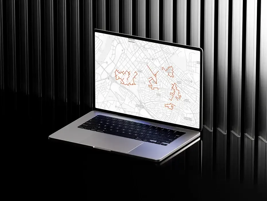
With Taal Healthtech, we reshaped not just the routing algorithm but how field teams operate: who to visit, in what sequence, and how to spend the day for maximum impact.
View case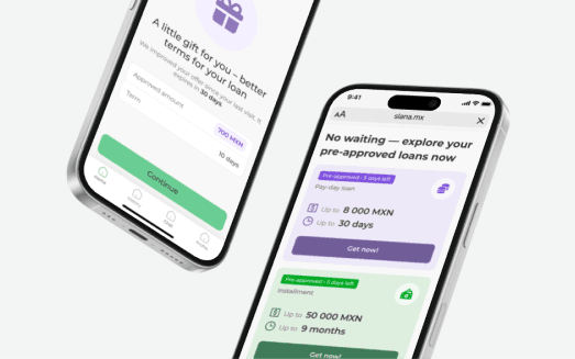
$lana (Monetech), a regulated multi-country consumer credit platform, needed its compliance and data integrations online inside a tight regulatory window. We owned the integration architecture and delivered.
View caseWe've been working with WislaCode since July 2025. What started as enhancing the loyalty program in our GlobalTips guest app grew into a broader partnership where they now handle significant frontend development across our guest app, staff app, and web products.
This was a very task-heavy project, mostly exploration and R&D-driven. However, by the end of WislaCode, we were left with a detailed roadmap consisting of clear milestones - able to be converted into tangible KPIs - and some neat ideas of what actionable are next. Integrating...
We collaborated with WislaCode on a product strategy development project and gave the highest marks for this contractor. The WislaCode team delivered on time and with outstanding quality.
Fleet visibility still arriving as end-of-day reports?
Describe the operation and we will map a monitoring system your dispatchers watch live.